
From the NWS in Peachtree City:
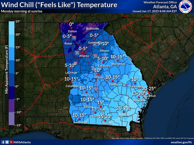
NOW is the time to prep for the cold! This is likely to be our most impactful cold snap of the season. Temperatures are expected to plummet! Temperatures around sunrise Monday morning are forecast at 10 to 25°F but breezy winds will result in ‘feels like’ temperatures in the single digits to low teens!
Forecast high temperatures Monday – Wednesday will range 20 to 30°F.
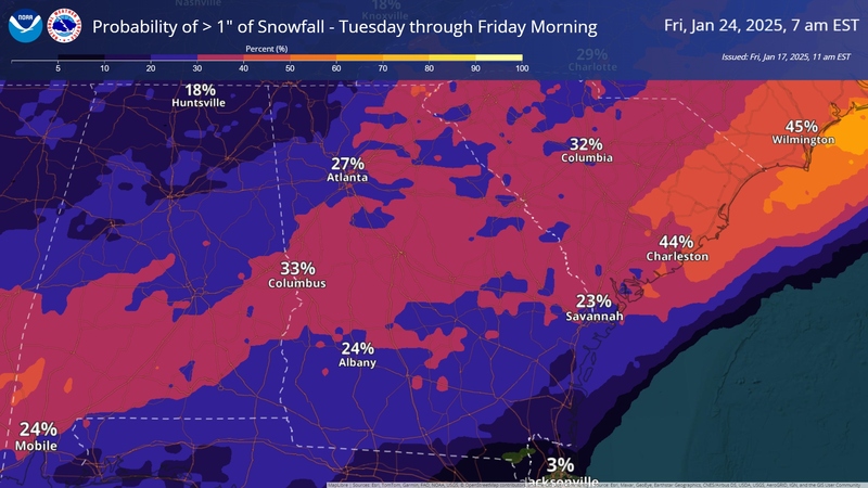
Will there be SNOW? Latest data suggests a timeframe sometime between Tuesday & Wednesday if impacts were to be felt in our area. Given expected temps & potential storm track – the whole state remains ‘in play’ for potential snow accumulations. While there is still quite a bit of spread in the potential position of the storm.